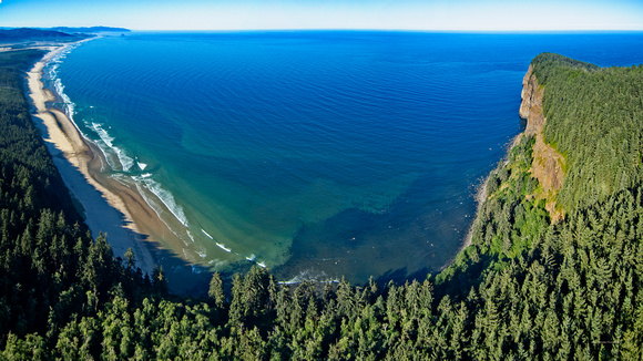
This is a panorama view from a point overlooking Cape Lookout south to Cape Kiwanda on the Oregon coast. The photo was captured by a drone - taking three photos in rapid succession and "stitching" them together in the editing process and cropping for a 16x9 aspect.
To the right is Cape Lookout, a basalt promontory that extends 2.5 miles into the sea. Cape Kiwanda is located in the upper left of the photo where a large offshore "sea stack" can been. [Our coast house is located near Cape Kiwanda]
I had perfect conditions to capture the photos needed to make this panorama, very clear air and no wind.
I have also posted a video short (01:32 in duration) captured on the same mission (pilot lingo for a flight) on my YouTube channel. Here's the link:
https://www.youtube.com/watch?v=JiOOZYuMsug